

blah blah blah
Mt. Jefferson
Length: 5.6 miles out-and-back with loopDifficulty (click for info): Extreme
Elevation Gain: 2700 feet
Rating (click for info): 10/10
Elevation: 5716'
Prominence: 753'
Driving Directions:
Trailhead and parking area are on Jefferson Notch Road, in Thompson and Meserve's Purchase, NH. To get there, take Base Station Road (sign for the Cog Railway) from the east side of Rt. 302, 4.4 miles east of Rt. 3. Base Station Road (sign for the Cog Railway) leaves Rt. 302 4.4 miles east of Rt. 3. Drive 4.4 miles up the road and turn left onto Jefferson Notch Road (look for a four-way intersection with dirt roads on the right and left). The parking area is 3.2 miles up this steep, winding dirt road.
About the Hike:
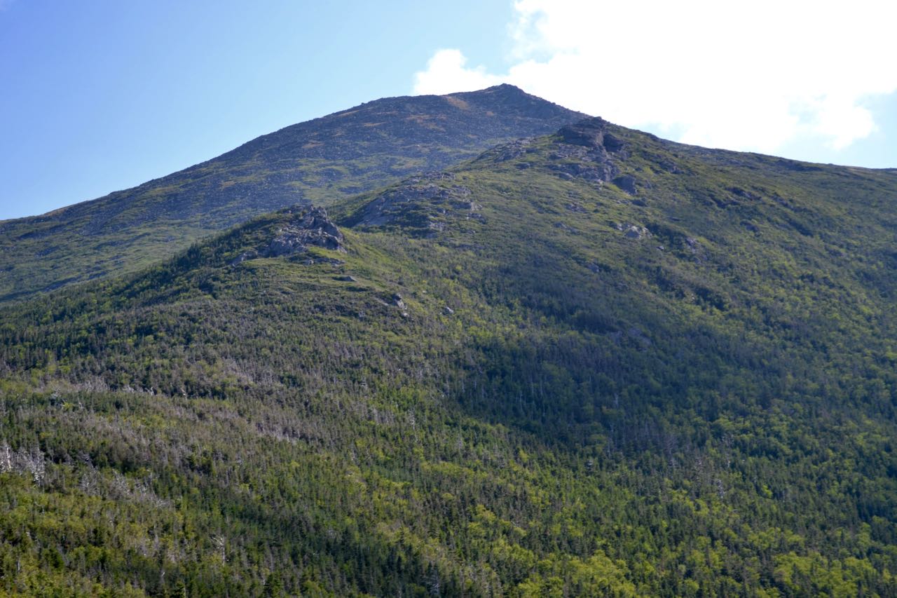
Mt. Jefferson is the third highest mountain in New Hampshire and is located in the middle of the Northern Presidentials ridge. Its view is not usually considered the best of the range because its distant views are blocked by towering Mt. Washington to the south and slightly higher Mt. Adams to the north. This means that you cannot see as far in many directions as you can from those two. However, what inclines some hikers to prefer Adams or Washington is also one of the most unique features of Mt. Jefferson. Because these higher mountains are so close, it has striking views of their slopes and ravines from all around the summit, most notably of Mt. Washington and the Great Gulf. Those who are looking to see mountain majesty up close will not be disappointed here. Aside from the view, much beauty is also found in the mountain itself. Like all of the Northern Presidentials, its slopes are covered with endless alpine fields of boulders, except for one unusual grassy expanse to the south of the summit, known as Monticello Lawn. The mountain's most notable features are its ridges, all of which are exceptionally rugged. The hike described here, clearly the most popular one on the mountain, ascends the Ridge of the Caps, named for its rock formations, "The Caps". While unusually short, the hike is strenuous, and the sections around the Caps involve much difficult rock scrambling. Views are continuous for over a mile on this wonderfully scenic trek.
The trail begins at Jefferson Notch, the highest (public) road-accessible point in the White Mountains. The trail heads into the woods, passes through a marshy area on bog bridges, and begins to climb gradually. After about 0.3 miles, the trail becomes steeper, and for the next 0.7 miles, it ascends moderately through a long chain of blowdown patches. It then reaches a small opening, where you must climb up to the top of an uplifted ledge for the view. The ledge itself is covered with bizarre circular indentations, known as "The Potholes". To the east, the Ridge of the Caps, the lower part of which you have climbed to get here, leads the way past the sharp, rocky Caps to lofty Mt. Jefferson, your destination. To the southeast, you look up to Mt. Clay. Below and between the two are ravines of three branches of Clay Brook. To the south, Mt. Monroe peeks over Clay's west ridge. To the right, down the Southern Presidentials ridge are Mt. Franklin, Mt. Eisenhower, and Mt. Pierce. In the distance to the right of Pierce are Mts. Carrigain and Hancock. Next over, and closer, is the Willey Range: Mts. Willey, Field, and Tom. To the west, in the distance, is the Twin Range, with the Little River Mountains in front. Closest to you is the minor Rosebrook Range, identified by the Bretton Woods Ski Area.
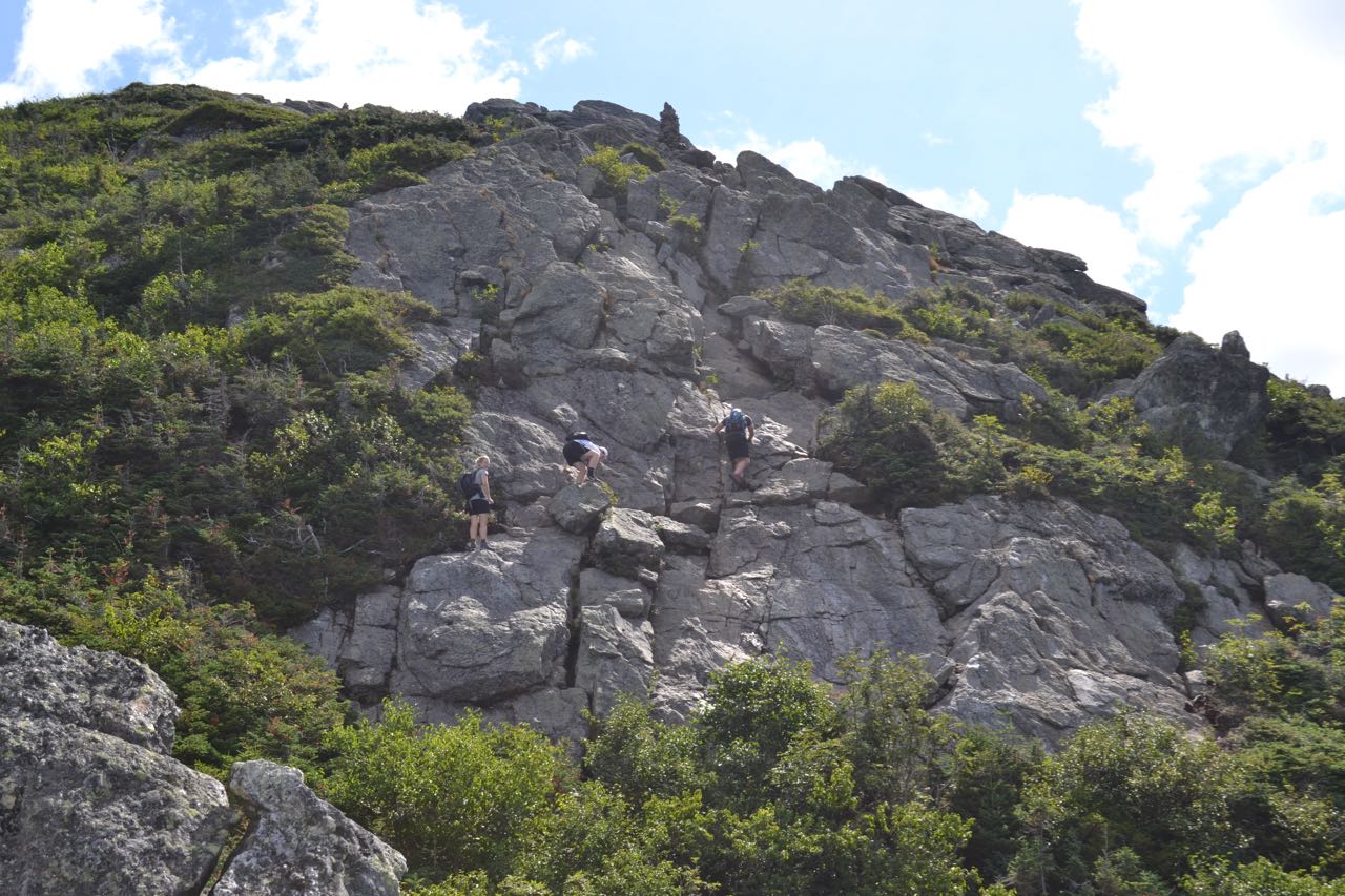
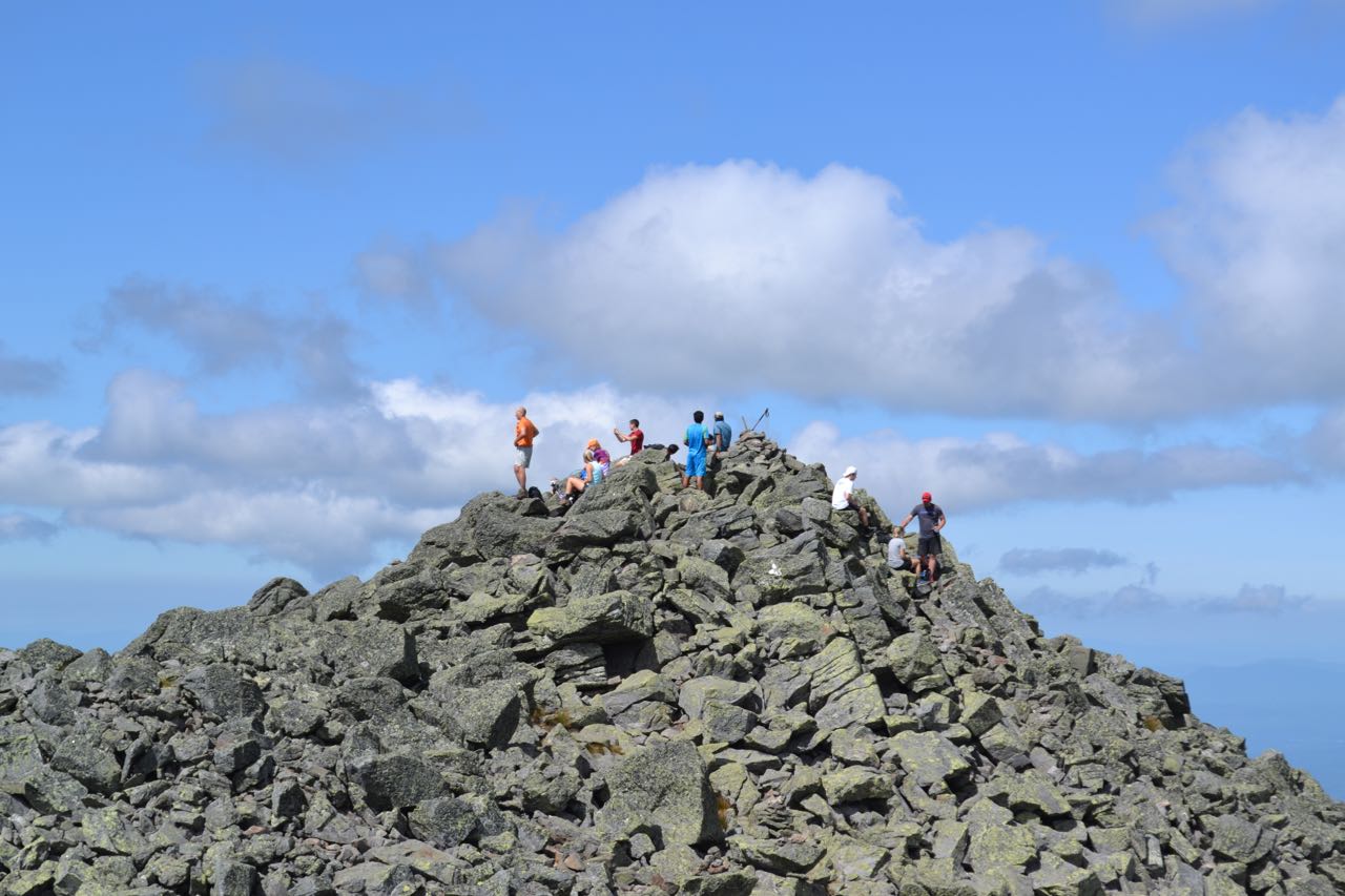
From the "Potholes" Ledge, continue on the Caps Ridge Trail, and in 0.1 miles, pass The Link on the left. The trail steepens beyond this, and climbs 0.3 miles, passing another good outlook on the right, then makes the first tricky rock scramble to the base of First Cap. Now in the open, the trail traverses to the other side of First Cap, then scrambles very steeply to the top. Watch carefully for markings as you make this difficult climb. Once over the ledges, the trail becomes an easy dirt path and leads around the side of the highest crags. Views are now excellent, and you can now see to the northwest, over the Cherry-Dartmouth Range. The trail continues to the base of Second Cap, then makes the most difficult climb of the trail up a huge, sheer rock face. The best way to overcome this daunting challenge is to weave back and forth as you clamber up the rock. The trail again eases at the top, and climbs moderately to Third Cap. After a few final rock scrambles, the trail weaves through the many crags at the top, then makes a minor descent to a small plateau. This is half a mile from First Cap. Views continue to increase as the trail climbs a gentler slope. In 0.2 miles, The Cornice joins Caps Ridge Trail from the left but quickly turns right off of it; this is where you will end a short loop at the top. Stay straight through this, remaining on Caps Ridge Trail. As you climb the final 0.4 miles, the trail steepens as it ascends over more and more boulders. As the trail approaches the summit, turn left and scramble steeply to the summit cairn.
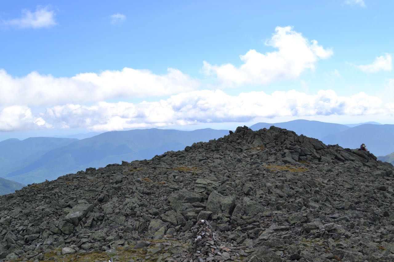
To the south, you look up the ridge past Mt. Clay to Mt. Washington. The view of the Great Gulf's rugged headwall is incredible. To the left of Washington, you can see the auto road as it climbs Chandler Ridge. To the east, the view looks over the Great Gulf to the Carter Range. To the northeast stands Mt. Adams, with the upper headwall of Jefferson Ravine below. To the north, far below Mt. Adams is the Crescent Range, with the Pliny and Pilot Ranges further away to their left. For a better perspective to the east, follow the trail down to a junction just below the summit and walk over the rocks to the east summit knob. You may also find this side far less crowded. To return to Caps Ridge Trail via a short, scenic loop, head to the junction previously mentioned and turn south (right, coming from Caps Ridge Trail) onto Mt. Jefferson Loop. Descend 0.3 miles, with majestic views of Mt. Washington ahead, to the grassy expanse of Monticello Lawn. Bear right onto Gulfside Trail and walk just over 0.1 miles, then turn right onto The Cornice. This trail descends gradually across the rocky slope for 0.5 miles back to Caps Ridge Trail.
Printable directions page